
North Mexico Common Airports
| Airport | ID | Apch | Tower | VOR | ATIS | Runway | Length | Elv | GPS Location |
|---|---|---|---|---|---|---|---|---|---|
| Mexicali | MMML | twr | 118.2 | 115.0 | 127.6 | 10 / 28 | 8530 | 72 | N32 37.8 W115 14.5 |
| Tijuana | MMTJ | 119.5 | 118.1 | 116.5 | 127.9 | 09 / 27 | 9711 | 499 | N32 32.5 W116 58.3 |
| Ensenada | MMES | twr | 119.75 | 400n | 11 / 29 | 4892 | 66 | N31 47.7 W116 36.1 |
|
| San Felipe | MMSF | twr | 118.5 | 13 / 31 | 5170 | 150 | N30 56.0 W114 49.0 |
||
| Puerto Penasco | MPPE | twr | 122.8 | 112.1 | 11 / 21 | 4900 | 30 | N31 21.0 W113 32.0 |
|
| Guaymas | MMGM | twr | 118.6 | 02 / 20 | 7700 | 89 | N27 58.0 W110 55.0 |
||
| Hermosillo | MMHO | 121.4 | 118.7 | 112.8 | 127.7 | 05 / 23 11 / 29 |
7546 3609 |
646 | N29 05.7 W111 02.8 |
| Ciudad Obregon | MMCN | twr | 118.3 | 115.1 | 127.6 | 13 / 31 | 7500 | 243 | N27 23.6 W109 50.0 |
| Loreto | MMLT | twr | 118.4 | 113.2 | 16 / 34 | 7218 | 10 | N25 59.4 W111 20.9 |
|
| Los Mochis | MMLM | twr | 118.8 | 115.5 | 09/27 | 6562 | 14 | N25 41.1 W109 04.9 |
|
| El Fuerte | XFTE | 122.8 | 14 / 32 | 4128 | 225 | N26 23.5 W108 36.0 |
|||
| San Blas | 122.8 | N26 04.1 W108 43.53 |
|||||||
| El Carrizo | 122.8 | N26 22.46 W109 01.45 |
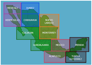
Foreflight Mexico VFR WAC Charts Downloads
While we recommend that Pilots purchase appropriate & current VFR/IFR Charts for Mexico
The following non-current VFR WAC Charts are available for reference.
 For Mexico VFR charts, you can import Mexico WAC VFR charts for use in ForeFlight. Here's a webpage that contains Mexico charts that were georeferenced by a ForeFlight customer. http://www.zeroslope.com/maps/) The direct Links are in the Next section.
Download these files via your PC. Move/Copy them to the iCloud Files directory. Go to your ipad Files App and tap on them to download them to your iPad. Then, tap on them again and the Share Icon to Send/Share them to ForeFlight. Be patient: these files are 400 MB each.
Mexico VFR Charts information (PDF)
While we recommend that Pilots purchase appropriate & current VFR/IFR Charts for Mexico
The following non-current VFR Charts are available for reference.
Whales Petting Trip
Mexico IFR Charts information (PDF)
While we recommend that Pilots purchase appropriate & current VFR/IFR Charts for Mexico.
The following non-current IFR Charts are available for reference.